Anyone who has tried to build, renovate, or buy land in a bushfire-prone part of Australia has run into the term Bushfire Attack Level sooner or later, usually attached to a planning condition, a builder’s quote, or a council request for further documentation. It’s a small piece of terminology that carries a surprising amount of weight, shaping everything from window glazing to subfloor construction, approval timelines, and final build cost. We work with this framework across projects in Perth and Sydney on a regular basis, and this guide brings together how the rating works, what drives it, and where it fits into the wider planning and building process in Australia.
Why This Standard Exists
Bushfire risk in Australia isn’t uniform. A block backing onto dense forest faces a very different exposure profile to one set within an established, well-managed suburb, even if both sit within the same general region. Australian Standard AS 3959, Construction of buildings in bushfire-prone areas, was developed to respond to that variability with a measurable, repeatable framework rather than a blanket rule applied evenly across every property.
The standard does this through the Bushfire Attack Level system. Rather than asking whether a fire might occur, which is unpredictable and largely outside anyone’s control, it asks a more answerable question: if a bushfire did reach this piece of land, how severe would the exposure be for a building sitting on it? That answer, expressed as a BAL category, becomes the basis for construction requirements under the National Construction Code, tying a technical fire-science assessment directly to material specifications a builder can quote against.
It’s worth understanding this framing early, because it explains why identical-looking blocks can carry different ratings, and why a rating obtained for one design or one point in time doesn’t automatically apply forever. Vegetation grows back after clearing, land use around a property changes, and even shifting where a dwelling sits on a block can move the final classification. A rating is a snapshot of conditions at the time of assessment, not a permanent fixture attached to the land itself.
This guide works through the full picture: how the scale is structured, what actually goes into calculating a rating, where the assessment shows up across a typical project, and how it shapes both design decisions and construction budgets from the ground up.
Reading the BAL Scale
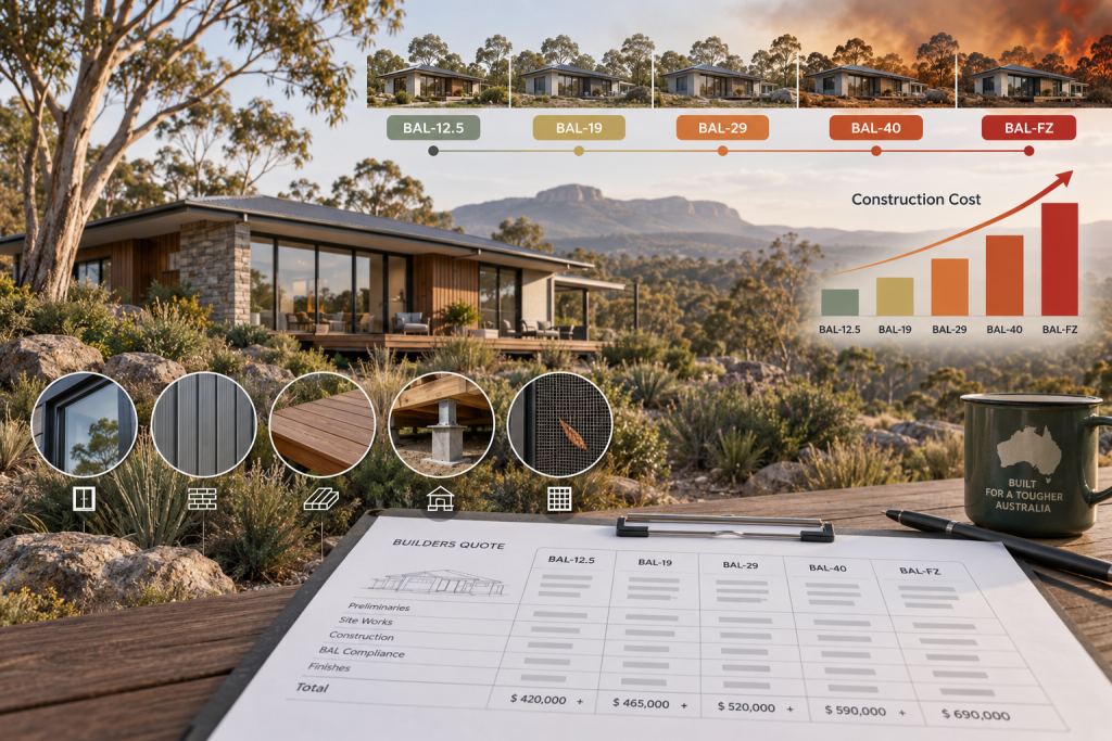
The BAL system sorts potential exposure into six categories, each triggering a different tier of construction requirement.
BAL-LOW – Minimal risk. No specific bushfire construction requirements under AS 3959 apply beyond standard building practice.
BAL-12.5 – Ember attack becomes the primary consideration, generally addressed through sealing gaps and fitting ember-resistant mesh.
BAL-19 – Ember attack continues, joined by a meaningful radiant heat component that pushes glazing and cladding specifications up a tier.
BAL-29 – Higher radiant heat exposure, typically requiring toughened glazing, screening, and bushfire-resisting timber.
BAL-40 – Significant radiant heat with likely direct flame contact, generally calling for non-combustible cladding and enclosed subfloors.
BAL-FZ (Flame Zone) – The most severe category, where direct flame contact is a realistic exposure, demanding the most stringent construction response across the entire building envelope.
Each step up this scale isn’t just a label, it’s a compounding set of material and construction obligations, which is why knowing where a site sits early in a project changes how the whole design and budget conversation unfolds.
What Actually Feeds Into the Number
A BAL rating isn’t an estimate pulled from a map or a postcode. It comes from a defined calculation method set out in AS 3959, applied to specific, measurable conditions on a given block.
Vegetation classification sits at the centre of the process. Assessors identify the type of vegetation surrounding a site, whether forest, woodland, shrubland, or grassland, since different vegetation types release and carry fire energy in different ways. Distance to that vegetation matters just as much, since exposure decreases as the buffer between classified vegetation and a proposed building increases. Slope underneath the vegetation is the third core factor, and often the one that surprises property owners most, because fire moves faster uphill, meaning vegetation on a slope below a building can produce a materially higher rating than the same vegetation on flat or downhill ground.
These inputs are run through a Fire Danger Index specific to the region, using either a simplified or a more detailed calculation method depending on site complexity, producing a radiant heat flux figure that maps directly onto one of the six BAL categories. A site producing a lower radiant heat flux lands toward BAL-12.5 or BAL-19, while a site producing a high figure can land at BAL-40 or Flame Zone. The method chosen matters too. A simplified calculation suits most standard residential blocks with straightforward vegetation and slope conditions, while a more detailed calculation is reserved for complex sites where a coarser method risks overstating the exposure and pushing the rating, and the resulting construction cost, higher than the land genuinely warrants.
For readers who want the calculation itself broken down step by step, [LINK-CLUSTER-What Is a BAL Rating and How Is It Actually Calculated?: the mechanics behind vegetation classification, distance, slope, and the resulting radiant heat flux figure] sets out exactly how assessors move from site data to a final number.
Where the Assessment Fits Into the Bigger Picture
A BAL assessment rarely arrives at a project in isolation. It tends to show up at one of several predictable points, and recognising them early avoids the scramble of discovering the requirement partway through a development application.
New residential construction on land within a designated bushfire prone area, where the assessment accompanies the building permit application.
Subdivision of land within a mapped zone, since each resulting lot can carry its own distinct exposure profile.
Reconstruction following fire or storm damage, generally treated the same as new construction for approval purposes.
Significant renovations or additions that increase a building’s footprint or habitable area, even on older properties built before current provisions applied.
Requests from lenders or insurers as part of underwriting, particularly for properties in higher-risk regions.
Council-requested reassessment where plans change materially after an initial rating, or where enough time has passed that surrounding vegetation conditions have shifted.
Not every property triggers every scenario, but the wider point holds across all of them: the assessment is rarely optional once one of these situations applies, and treating it as an afterthought tends to stall approvals rather than avoid the requirement. [LINK-CLUSTER-Do You Need a BAL Assessment? 7 Situations That Trigger One: a closer look at the specific circumstances, including the ones that catch renovators and land buyers off guard] walks through these triggers in more detail.
Checking Land Before You Commit to It
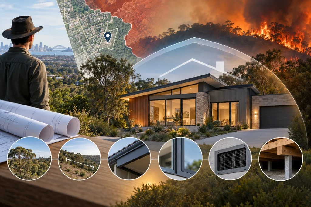
For anyone still at the stage of choosing a block, the smartest move happens before an offer is even made. Every state maintains a bushfire prone area map, produced by the relevant fire authority or planning department, that flags land falling within a designated risk zone. In Western Australia this sits within the Map of Bush Fire Prone Areas; in New South Wales it’s managed through the Rural Fire Service’s bushfire prone land mapping.
It’s worth being clear about what these maps do and don’t tell a buyer. Falling inside a mapped zone doesn’t hand you a BAL category, it simply flags that a formal assessment will be required before development can proceed. Equally, sitting just outside a mapped boundary doesn’t guarantee there’s nothing to consider, particularly on larger rural blocks where conditions can shift over time as vegetation regrows or land use around a property changes. The map also can’t capture the specific vegetation classification, slope, or distance conditions that actually determine the rating, which means two blocks flagged on the same overlay can land at very different points on the BAL scale once assessed properly.
A satellite image can give a rough sense of how much greenery surrounds a block, but it can’t classify vegetation type with any accuracy, measure slope with precision, or apply the calculation method that produces an actual number. Buyers who treat the map as step one of due diligence, rather than the final word, tend to avoid the unpleasant surprise of discovering a high rating only after settlement, when redesigning around a construction requirement is far more disruptive than accounting for it during the offer stage. [LINK-CLUSTER-How to Read a Bushfire Attack Level Map Before You Buy Land: what the overlay actually shows, and the gaps a proper site assessment fills in] covers exactly what to check before signing anything.
BAL Assessment or Something More: Knowing the Difference
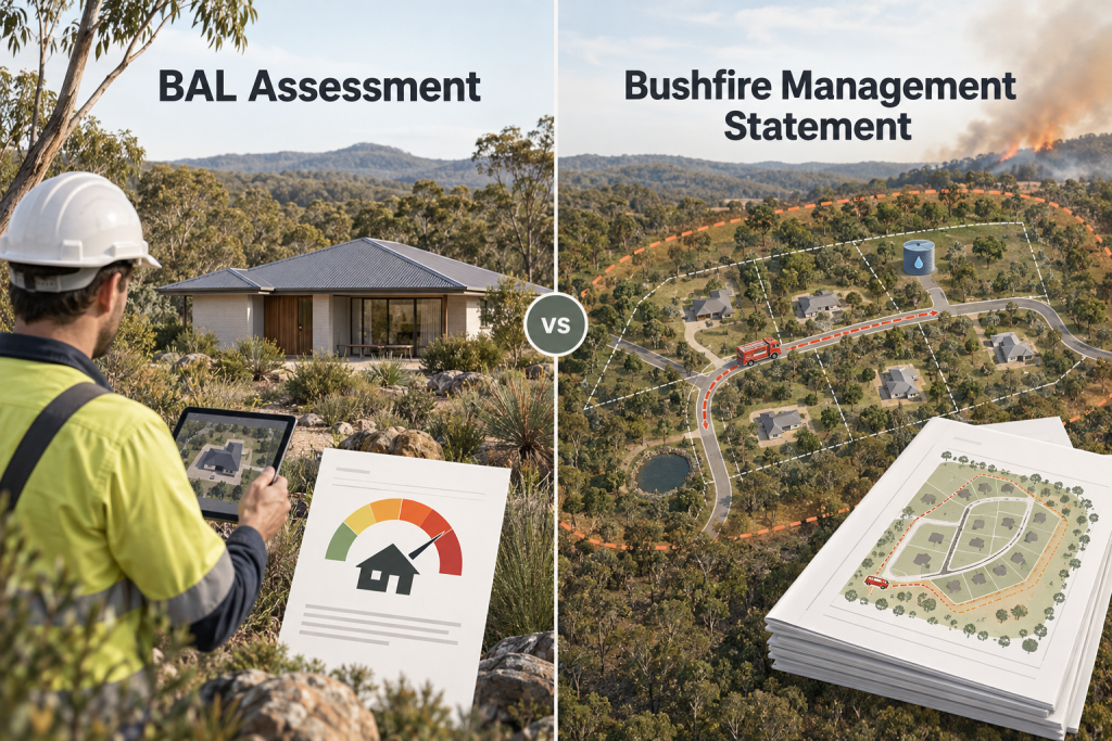
Not every bushfire-prone site is satisfied by a standard BAL assessment alone. In areas of higher overall risk, or for larger developments such as subdivisions, councils and state planning frameworks sometimes require a more comprehensive document, often referred to as a Bushfire Management Statement or Bushfire Management Plan depending on the jurisdiction.
This broader document incorporates a BAL assessment as one component but goes further, addressing asset protection zones, emergency vehicle access, water supply for firefighting purposes, and how a development sits within the wider surrounding landscape rather than just the footprint of a single dwelling. It generally involves a longer preparation time and a higher level of council or fire authority scrutiny than a standalone BAL assessment. Knowing which document a project actually needs, rather than assuming the simpler one will cover a more complex site, saves a meaningful amount of back-and-forth with council. [LINK-CLUSTER-BAL Assessment vs Bushfire Management Statement: What’s the Difference?: where the line sits between the two, and which projects tend to need the fuller document] breaks the distinction down clearly.
How Construction Requirements Shift With the Rating
Once a category is confirmed, it stops being paperwork and becomes a construction brief. AS 3959 attaches specific requirements to each element of a building envelope that fire can exploit: roof coverings and penetrations, external wall cladding, windows and glazed doors, decking and attached timber structures, subfloor construction, and ventilation openings.
At the lower end of the scale, requirements focus on sealing gaps and fitting ember-resistant screening, since ember attack rather than direct heat is the primary concern at BAL-12.5. Moving up through BAL-19 and BAL-29, radiant heat resistance becomes the dominant concern, pushing glazing toward toughened glass, cladding toward bushfire-resisting alternatives, and timber selections toward species proven to withstand sustained heat exposure without igniting. Builders working within this range are often still using a broadly familiar material palette, just specified to a higher standard.
At BAL-40 and Flame Zone, the response shifts from upgraded standard materials to largely non-combustible construction, fully enclosed subfloors, and glazing systems built to withstand direct flame contact rather than just radiant heat. This is also where lead times for specialised, purpose-built materials start to influence project schedules almost as much as the construction cost itself, since these products are typically sourced from a narrower range of suppliers than standard building materials. Builders and owners working at this end of the scale tend to get better outcomes when the material specification is settled early, rather than discovered midway through a build once standard products turn out not to comply.
What Shapes Cost and Timeframes
Cost is one of the most variable parts of the entire process, and for good reason: both the assessment fee and the eventual construction cost respond directly to how complex a given site turns out to be. A straightforward suburban block with limited surrounding vegetation and a simple calculation typically costs less to assess and less to build on than a rural property with mixed vegetation classifications, significant slope, and a more detailed calculation method required.
Accessibility and documentation requirements add further variation. A site that’s straightforward to walk, photograph, and measure costs less to assess than one needing multiple visits or difficult access, and some councils and certifiers request a fuller written report with mapping and photographic evidence than others, which adds to the scope of the work. Seasonal demand can nudge timelines too, particularly ahead of periods when development applications tend to spike before a building season begins.
The choice between the simplified and detailed calculation approaches under AS 3959 also plays into this. The detailed method takes longer and costs more upfront, but on a complex site it can prevent an unnecessarily high classification that would otherwise inflate construction costs well beyond what the assessment itself cost to prepare. On the construction side, the material shift required at higher BAL categories, particularly non-combustible cladding and flame-rated glazing at BAL-40 and above, tends to have a far larger effect on the overall project budget than the assessment fee ever does. Getting a realistic sense of both figures early, before a design is locked in, tends to produce budgets that actually hold up through construction rather than needing revision once a rating comes back partway through the approval process.
State-by-State Differences Worth Knowing
While AS 3959 provides the national construction standard, how the assessment fits into the planning and approval process varies by state. In Western Australia, the process sits within State Planning Policy 3.7: Bushfire, working alongside local government planning schemes, and generally requires assessments to be carried out by an accredited BAL Assessor or Bushfire Planning Practitioner, with more complex sites needing a higher level of accreditation for detailed contour mapping. Developments landing in BAL-40 or Flame Zone in WA often require separate planning approval in addition to a standard building permit, reflecting the higher scrutiny these ratings carry.
In New South Wales, the process runs through the NSW Rural Fire Service’s bushfire prone land framework and Planning for Bush Fire Protection guidelines, with BAL certification required for Complying Development on bushfire-prone land and assessments expected from BPAD-accredited practitioners. Other states run comparable systems built on the same underlying AS 3959 construction standard, generally combining a state-administered bushfire prone area map with local council oversight of how the rating feeds into a development or building application.
The underlying construction standard is the same AS 3959 framework used nationally, but the specific documentation, sign-off requirements, and local council expectations differ enough between states, and even between individual councils within the same state, that assuming a process from one region applies identically elsewhere is a common and avoidable mistake. Anyone working across more than one state on a project, or relocating a build from one region to another, is better served confirming the local pathway early rather than assuming familiarity from a previous project carries over directly.
Turning the Rating Into a Build That Works
A BAL rating is ultimately a planning tool disguised as a technical figure. It exists to make sure a building responds honestly to the conditions actually surrounding it, rather than being built to a generic standard that either overprotects an unremarkable block or underprotects one facing genuine exposure. Understood early and factored into design decisions from the outset, a rating becomes a straightforward input rather than a late complication, shaping material choices, siting, and budget expectations well before a permit application is lodged.
We work through every stage of this process with clients across Perth and Sydney, from checking a block against the mapping before an offer is made, through to matching the right assessment method to a site and carrying that information into design and drafting decisions that hold up under council review. The projects that move through approval with the fewest hiccups are consistently the ones where the rating was treated as a starting point for design, not a hurdle to clear once plans were already drawn.
If you’re working through a bushfire-prone project and want the classification handled properly from the start, reaching out at the design stage rather than after plans are finalised tends to make the rest of the process considerably more straightforward, both for your timeline and for what the final build ends up costing.