Ask three different property owners what their Bushfire Attack Level assessment cost, and you’ll likely get three different figures, even if their blocks sit in the same postcode. That’s not inconsistency in the industry, it’s a reflection of how the assessment itself works. The rating depends on site-specific variables, and so does the cost of arriving at it. We put together assessments across Perth and Sydney regularly, and this breaks down what actually moves the price up or down.
There’s No Standard Rate, and That’s by Design
A BAL assessment isn’t a flat-fee service in the way a building inspection often is. The cost reflects the time and method needed to classify a specific site under AS 3959, and that varies with the land itself. A straightforward suburban block with clear boundaries and minimal surrounding vegetation takes far less assessor time than a rural property backing onto native bushland with varied topography.
This is worth knowing upfront, because it explains why online cost estimates from generic sources rarely match what a quote actually comes back as. The number only becomes accurate once someone has looked at the property.
The Core Factors That Set the Base Price
A handful of variables consistently shape what an assessment costs, regardless of who carries it out.
Site size and boundary complexity – larger or irregularly shaped blocks take longer to measure and map accurately.
Vegetation coverage – properties with multiple vegetation classifications around them (forest on one side, grassland on another, for instance) require more detailed classification work than a single, uniform vegetation type.
Topography – sites with significant slope variation need more careful measurement, since slope under vegetation directly affects the calculation.
Accessibility – a site that’s easy to walk and photograph costs less to assess than one requiring difficult access or multiple visits.
Documentation required – some councils and certifiers ask for a fuller written report with mapping and photographic evidence, which adds to the scope.
None of these factors operate in isolation. A large rural block with mixed vegetation and steep terrain will combine several of them at once, which is usually where costs sit at the higher end of the range.
Simple Sites Move Faster Than Complex Ones
A block in an established suburb, set back from bushland reserves with managed landscaping nearby, is often assessed and reported within a short turnaround. There’s less ground to cover, fewer vegetation types to classify, and the calculation itself tends to be more direct.
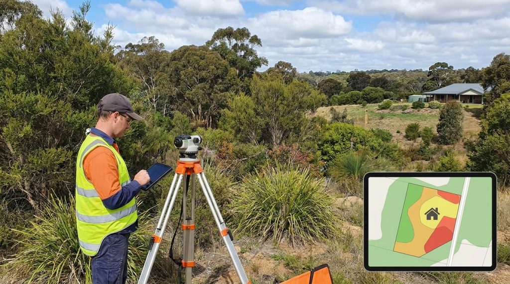
Compare that with a semi-rural or bushland-adjacent property. Here, an assessor might need to classify vegetation on multiple boundaries, measure slope at several points, and account for how different sections of the site interact with each other under the standard. More site time translates directly into more assessment time, and that’s reflected in the final cost.
Method 1 or Method 2: Not Just a Technical Choice
AS 3959 allows two calculation approaches, and which one applies to a site has a direct bearing on price.
Method 1 is the simplified calculation, generally suited to standard residential blocks with straightforward vegetation and slope conditions. It’s quicker to complete and typically sits at the lower end of the cost range.
Method 2 is a more detailed calculation used where site conditions are complex, or where a precise result is needed to avoid an unnecessarily high classification. It takes more time to complete correctly, and the additional rigour is reflected in the fee.
In some cases, opting for the more detailed Method 2 calculation, despite the higher upfront cost, ends up saving money overall by avoiding an over-classified rating that would otherwise push construction costs up through unnecessary material and detailing requirements.
Where You’re Building Plays a Part Too
Location affects pricing in a couple of practical ways. Travel distance to the site is one, since assessors based in Perth or Sydney factor in the time and distance to reach properties on the urban fringe or in more remote pockets. Local council requirements are another; some councils have specific formatting or reporting expectations for BAL documentation submitted with a development application, and meeting those can add a small amount of extra scope compared with a general-purpose report.
Seasonal demand can also nudge timelines and, occasionally, pricing, particularly leading into periods when development applications tend to spike ahead of a building season.
The Costs That Sit Alongside the Assessment
A BAL rating rarely arrives in isolation on a project. It often gets requested at the same stage as other planning and design documentation, and bundling that work can shift the overall cost picture even if the assessment fee itself stays the same. Sites already being assessed for thermal performance or energy compliance, for example, sometimes have vegetation and site data that overlaps with what a BAL assessor needs, which can streamline the process rather than duplicate it. Councils occasionally request an updated assessment if plans change significantly after the first report, which is worth factoring in in the early stages of concept design rather than after working drawings are finalised.
Getting the classification and the cost right early tends to save far more than it costs, since it shapes decisions on material selection and construction detailing well before a permit application is lodged. We work through this with clients across Perth and Sydney regularly, matching the assessment method to the site rather than defaulting to the more expensive option, and can talk you through what a specific property is likely to involve. If you’re at the stage of narrowing down land before committing to a purchase, this guide to reading a Bushfire Attack Level map before you buy is a useful next step.